


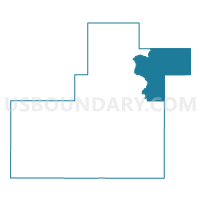
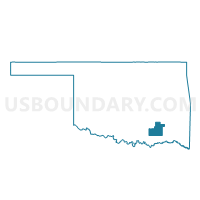
Voting District 14, Atoka County, Oklahoma
About
Outline

Summary
| Unique Area Identifier | 653493 |
| Name | Voting District 14 |
| County | Atoka County |
| State | Oklahoma |
| Area (square miles) | 98.78 |
| Land Area (square miles) | 98.44 |
| Water Area (square miles) | 0.35 |
| % of Land Area | 99.65 |
| % of Water Area | 0.35 |
| Latitude of the Internal Point | 34.52970570 |
| Longtitude of the Internal Point | -95.78583120 |
Maps

Graphs
Select a template below for downloading or customizing gragh for Voting District 14, Atoka County, Oklahoma


Neighbors
Neighoring Voting District (by Name) Neighboring Voting District on the Map
- Voting District 12, Atoka County, OK
- Voting District 13, Atoka County, OK
- Voting District 15, Pushmataha County, OK
- Voting District 20, Pittsburg County, OK
- Voting District 38, Pittsburg County, OK
- Voting District 43, Pittsburg County, OK
- Voting District 5, Pushmataha County, OK
- Voting District 7, Pushmataha County, OK
Top 10 Neighboring County Subdivision (by Population) Neighboring County Subdivision on the Map
- Antlers CCD, Pushmataha County, OK (5,892)
- Hartshorne-Haileyville CCD, Pittsburg County, OK (5,084)
- North Pushmataha CCD, Pushmataha County, OK (3,033)
- Kiowa-Pittsburg CCD, Pittsburg County, OK (2,125)
- North Atoka CCD, Atoka County, OK (1,449)
Top 10 Neighboring Elementary School District (by Population) Neighboring Elementary School District on the Map
Top 10 Neighboring Unified School District (by Population) Neighboring Unified School District on the Map
- Haileyville Public Schools, OK (2,591)
- Kiowa Public Schools, OK (1,782)
- Clayton Public Schools, OK (1,633)
- Stringtown Public Schools, OK (929)
- Pittsburg Public Schools, OK (694)
Top 10 Neighboring State Legislative District Lower Chamber (by Population) Neighboring State Legislative District Lower Chamber on the Map
- State House District 17, OK (36,307)
- State House District 20, OK (35,429)
- State House District 19, OK (34,076)
Top 10 Neighboring State Legislative District Upper Chamber (by Population) Neighboring State Legislative District Upper Chamber on the Map
Top 10 Neighboring 111th Congressional District (by Population) Neighboring 111th Congressional District on the Map
Top 10 Neighboring Census Tract (by Population) Neighboring Census Tract on the Map
- Census Tract 977, Pushmataha County, OK (5,892)
- Census Tract 4867, Pittsburg County, OK (5,084)
- Census Tract 976, Pushmataha County, OK (3,033)
- Census Tract 4868, Pittsburg County, OK (2,125)
- Census Tract 5876, Atoka County, OK (1,449)
Top 10 Neighboring 5-Digit ZIP Code Tabulation Area (by Population) Neighboring 5-Digit ZIP Code Tabulation Area on the Map
- 74525, OK (10,112)
- 74536, OK (1,760)
- 74560, OK (635)
- 74569, OK (633)
- 74557, OK (464)
- 74540, OK (172)